20190524_083124_2.jpg
Pianosa Research Base
National Research Council
20190524_083124_2.jpg
Pianosa Research Base
National Research Council
20190524_083124_2.jpg
Pianosa Research Base
National Research Council

Geology

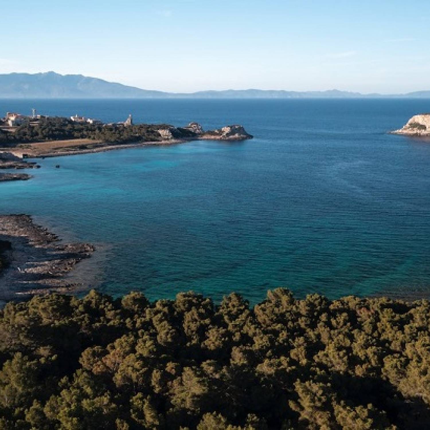
Pianosa belongs to the Tuscan Archipelago, with an area of 10 km2, 18 km of coastal development and a maximum altitude of 29 m a.s.l.. The island is a small emerged portion of an underwater ridge - Dorsale di Pianosa (Pianosa Ridge), which splits the Tyrrhenian Basin into two parts: the former is located between the Ridge and Corsica Island, reaching 800 m depth; the latter between the Ridge and the mainland with a maximum depth of 400 m.

Angular discrepancy between the Marina del Marchese (Burdigalian (da verificare)) Formation and the lower unit of the Pianosa (Piacenzian (da verificare)) Formation.

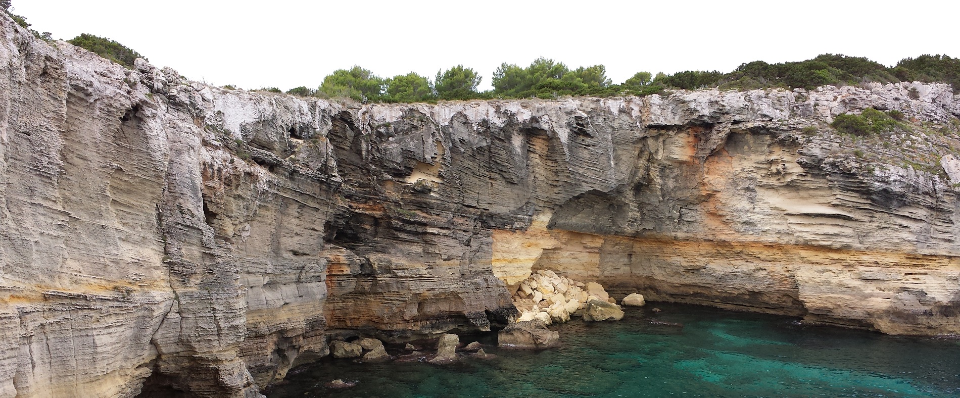
The ancientmost successions, emerging at the base of the western cliff, date back to the Miocene period: the Marina del Marchese Formation and the Golfo della Botte Formation. The former is of Burdigalian age and is characterized by an outcropping thickness of about 150 m of marly turbiditic clays of an external platform; the Formation of Golfo della Botte is of upper Tortonian-lower Messinian age and it is characterized by 300 m of sandy clays and conglomerates in the upper part, deposited first in a lake environment and finally in a marine lagoon-coastal type. The Golfo della Botte Formation overlooks the Marina del Marchese Formation in discordance with a stratigraphic gap between the two units that includes the upper Burdigalian - lower Tortonian interval.

Pianosa Formation, Upper Unit: diving clinoforms towards the south at Cala del Bruciato

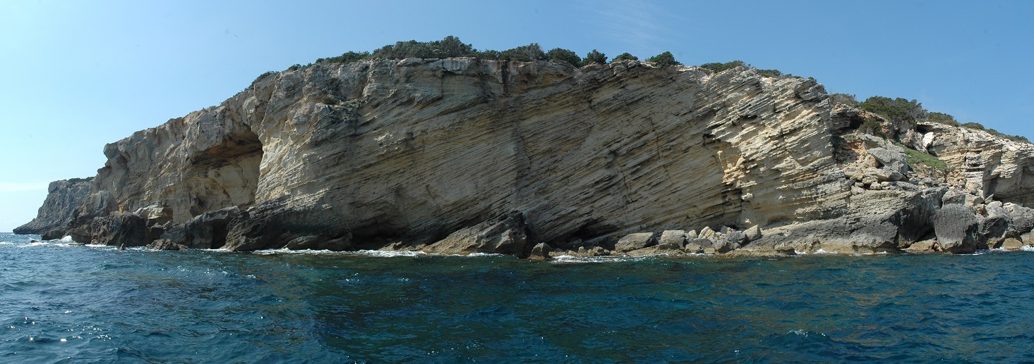
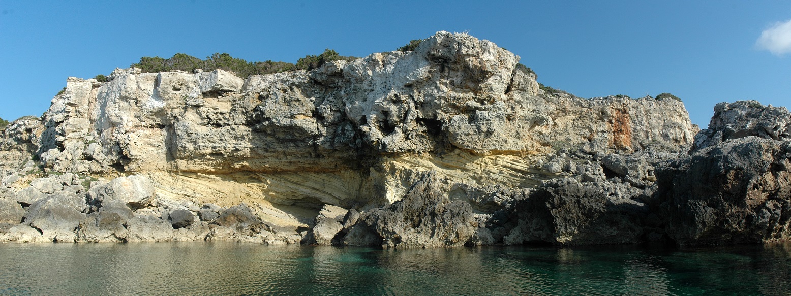
The Pianosa Formation extends over both Miocene formations, with marked angular discordance. This formation is made up of about 30 m of biocalcarenites, arranged from sub-horizontal to clearly clinstratified, rich in fossils, especially Mollusks and Algae, along with Bryozoans, Echinoids, Crustaceans and Fishes remains that testify a marine deposition of an internal platform . Two sedimentary units are recognized in the Pianosa Formation: the lower one refers to the Piacenziano and the upper one to the Calabrian. Therefore, this area of the Tuscan Archipelago also experienced the elevation of the Upper Piacenziano -Gelasiano, widely recognized in the Tyrrhenian sector of the northern Apennines.
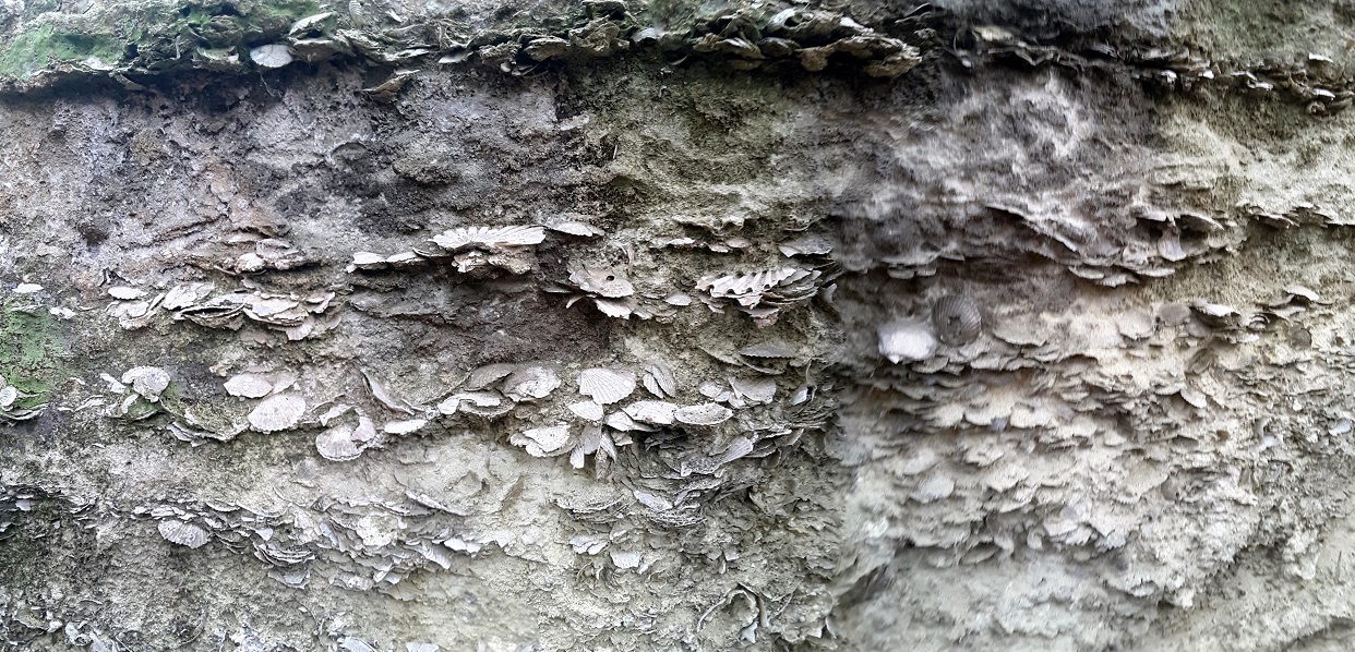
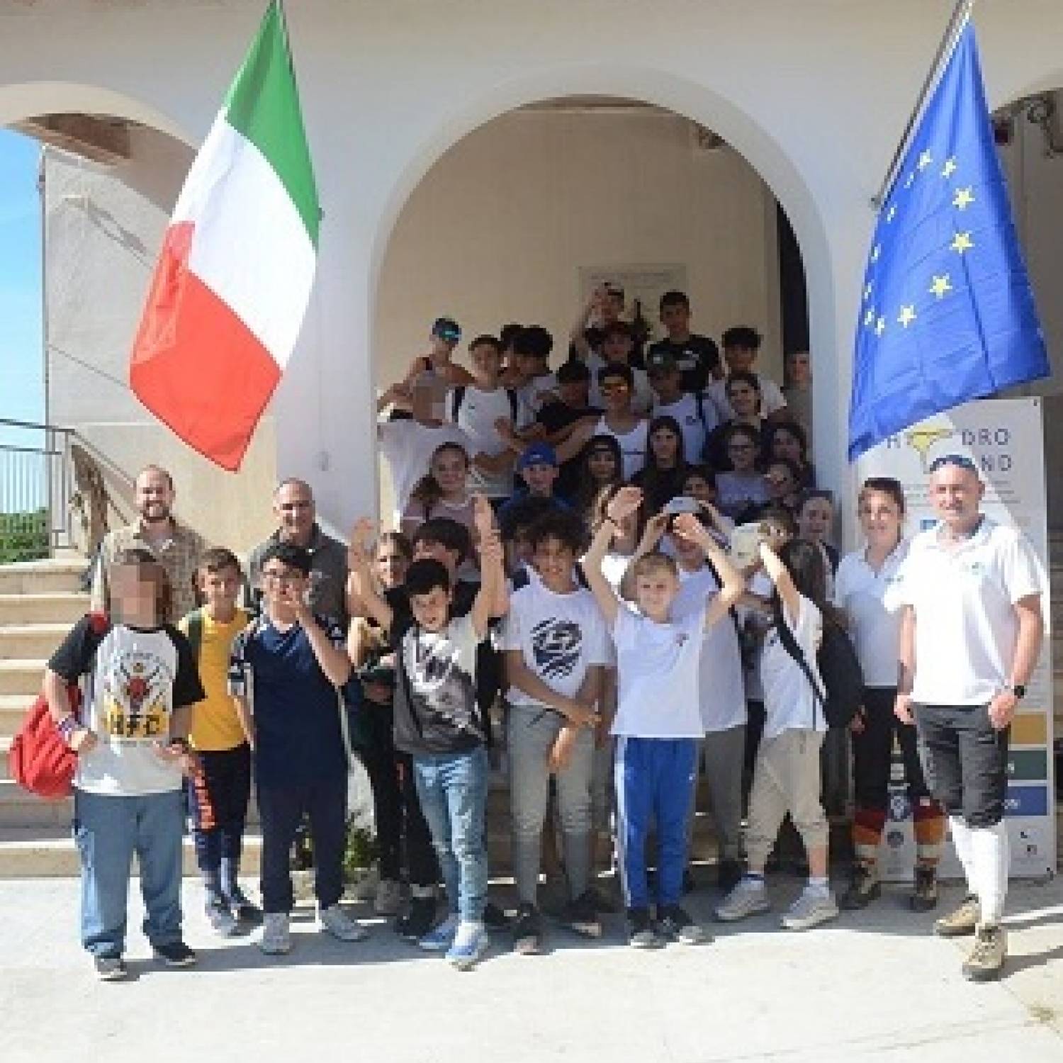
Upper Pleistocene shell deposits
at Cala dei Turchi

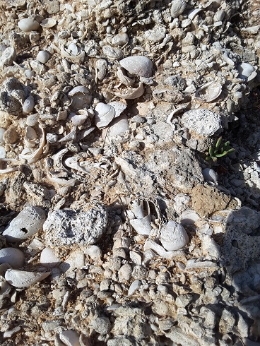
The last phase of marine deposition is represented by the shell deposits ("Bench") of the upper Pleistocene age, relating to the last interglacial phase. These deposits, lying horizontally and in discordance on the Pianosa Formation, are rich in fossils, especially Mollusks. Among these have been recognized Conus ermineus, Persistrombus latus and Patella ferruginea, known in literature as "warm guests". More recent deposits, still of upper Pleistocene age, existing along large sectors of the southern and eastern coasts, can be framed in a continental environment. They are sands immersed in a reddish clayey-marly matrix with breccias or sometimes a paleo-soil at the base. These sediments belong to the last glacial phase and often cover the shell deposits in discordance, protecting them from subaerial erosion. Currently they are partly submerged by the sea and their position is often inclined like the coastal slope.

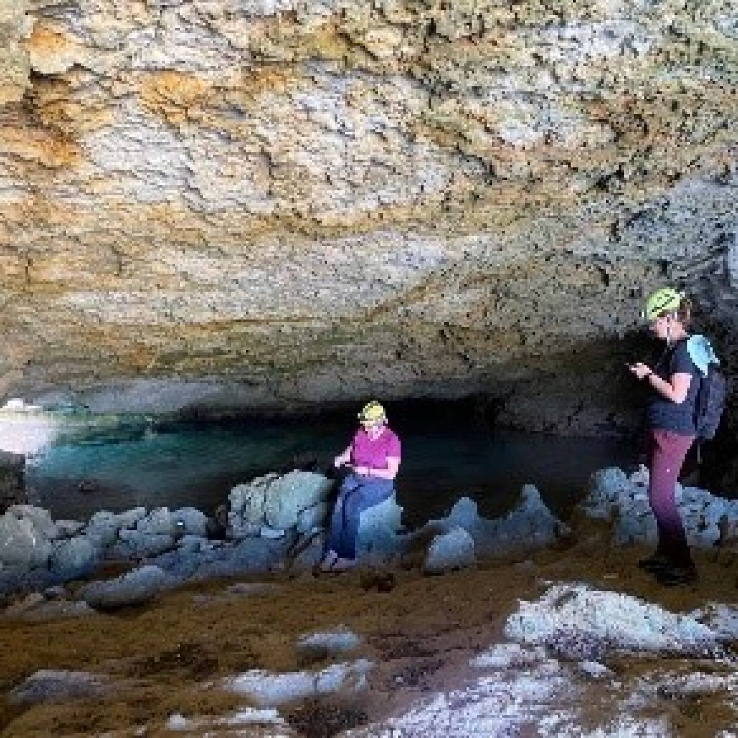
Heterometric and monogenic breccias are commonly found along the coast, near small isolated rocky promontories. They are composed of elements up to 2 m in size always immersed in a reddish sandy-marly matrix. Inside the matrix are rare bone fragments of terrestrial vertebrates and several shells of pulmonate gastropods, among which Tacheocampylaea sp is common. These breccias represent the instant deposition due to the collapse of karstic caves. Other deposits are represented by the filling of inlets and cavities. These are sandy-clayey sediments of a reddish color, which commonly contain remains of vertebrates, pulmonate gastropods and sometimes lithic and bone artifacts of the Neolithic period. Currently the deposition on the island is due only to sporadic colluvial processes.

Pianosa Formation, Upper Unit: fossiliferous levels in the artificial cuts of the abandoned quarry of Cala Giovanna

20 June 2023

On June 20 th and 21 st 2023, an UNESCO team consisting of Jonathan Baker, Jing Fang and Megumi Watanabe, was hosted at the Base Ricerca Pianosa of the CNR (BRP-CNR) during the visit on the Pianosa Island made for evaluating the work carried out during the HYDRO-ISLAND project. During the first...

01 June 2023

On 24th April 2023, the project HYDRO-ISLAND (UNESCO Project) and its preliminary results have been presented at the International Meeting EGU (European Geoscience Union) held in Wien from 23rd to 29th April 2023. During the presentation the ongoing research activities and the main results about...

29 May 2023

On 6th and 7th March 2023, some educational meetings were held with the students of the State Comprehensive Institute of “Giuseppe Giusti” (Secondary School in Marina di Campo - 2°B, 3°A e 3°B), of the Comprehensive Institute of Portoferraio “Giovanni Pascoli” (Secondary School - 3°A, 3°B and...

29 May 2023

On March 22nd and 24th and on May 5th 2023, field trips on Pianosa Island were held with the students of the Comprehensive Institute of Portoferraio “Giovanni Pascoli” (Secondary School - 3°A, 3°B and Monoennio), of the State Institute of Higher Education "Raffaello Foresi" (High School in...

09 May 2023

In the framework of five-year project PianosaLAB2 - Soil ecosystem hub, the Pianosa Island Research Base of the National Research Council of Italy, which is part of eLTER Italy ed eLTER Europe, hosted a mission of the Institute for Bioeconomy(IBE) of CNR, from May 9th to 17th 2023. The mission was...

06 May 2023

REPORT ON THE ERIS eLTER MISSION ON PIANOSA Project: Factors influencing biodiversity in underground habitats from Pianosa Island (CAVERNBIODIV) May the 6 th to the 18 th , 2023 Institution: Emil Racoviţă Institute of Speleology (ERIS), Bucharest (Romania), Romanian Academy - Partner: Group for...

06 February 2023

The HYDRO-ISLAND project (Pianosa Island; UNESCO program) and the related preliminary results will be presented in the context of a cycle of online thematic meetings organized for the candidacy process of the Euganean Hills as a Biosphere Reserve according to the UNESCO MAB program. The specific...

27 July 2022

The project HYDRO-ISLAND (Pianosa Island: hydrological processes and water resources sustainability in a climate-changing Mediterranean - P.I.: Marco Doveri, IGG-CNR, marco.doveri@igg.cnr.it) has been funded by UNESCO among many proposals from Europe, in the frame of the program “Promoting...

05 April 2022

During the first couple of weeks in April 2022, a new multiparametric weather station and a new precision lysimeter have been installed on the Pianosa Island as well as the completion and the activation of the hydrological and hydrogeological monitoring network. The new network includes 8 wells,...

18 March 2022

The exploratory survey of the Pianosa island subsoil have started. Researchers from the Institute of Geosciences and Earth Resources of the National Research Council (IGG-CNR) are engaged at the Base Ricerca Pianosa of the National Research Council (BRP-CNR) to support, from a technical-scientific...

29 November 2021

Geophysical studies of the Pianosa island have started in late November 2021 Researchers of the CNR-IGG, hosted in the BRP, carried out measurements of the subsoil electrical resistivity applying electrical and electromagnetic geophysical methods. These studies are aimed at increasing knowledge...

20 September 2021

Preliminary tests for the implementation and modernization of the hydrological and hydrogeological monitoring network began in the second half of September 2021. The new monitoring network will interest various sites on the Pianosa island and will make use of remote controlled data transmission...